Grand Canyon Hiking Trails: Best Routes for Every Skill Level
TL;DR: The Grand Canyon offers hiking trails for all abilities. For a first-time visitor, the Bright Angel Trail to the Mile-and-a-Half Resthouse (moderate, 3 miles round-trip) gives a taste of the canyon without full commitment. For a challenging day hike, South Kaibab Trail to Ooh Aah Point (moderate, 1.8 miles) yields incredible views with manageable effort. Always carry at least 1 gallon of water per person per day, start early, and never hike from rim to river and back in one day.
Why Hiking the Grand Canyon Is a Bucket-List Experience
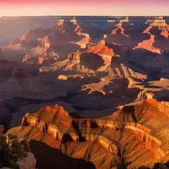
The Grand Canyon’s layered red rocks, vast expanse, and dramatic switchbacks make every hike unforgettable. Whether you stay on the rim or descend into the inner gorge, the ever-changing light and geology reward every step.
Essential Safety Tips Before You Go
- Water: Carry at least 1 gallon (4 liters) per person per day. Refill stations are scarce below the rim.
- Heat: Temperatures in the inner canyon can exceed 40°C (104°F) from May to September. Hike before 10 AM or after 4 PM.
- Footwear: Sturdy hiking boots with ankle support are essential. Trails are rocky and steep.
- Permits: Day hikes do not require permits. For overnight backpacking, reserve a backcountry permit months in advance (limited availability, released on a rolling basis).
- Altitude: The South Rim is at ~2,100 m (7,000 ft). Take it easy on day one to avoid altitude sickness.
Best Grand Canyon Hiking Trails by Skill Level
Easy Trails
- South Rim Trail: Paved, flat, ~13 miles one-way but you can walk any segment. Offers panoramic views with minimal effort. Wheelchair accessible. Length: Varies; popular section from Mather Point to Yavapai Observation Station is 0.6 miles. Elevation gain: Negligible.
- Trail of Time: A 2.8-mile accessible trail along the rim with interpretive signs marking geologic eras. Perfect for families.
Moderate Trails
- South Kaibab Trail to Ooh Aah Point: 1.8 miles round-trip, 180 m (600 ft) elevation gain. Unobstructed views from the start. Caution: steep drop-offs, no shade.
- Bright Angel Trail to Mile-and-a-Half Resthouse: 3 miles round-trip, 250 m (800 ft) elevation gain. Resthouse with water (seasonal) and shade. Good intro to descending.
- Grandview Trail to Horseshoe Mesa: 6 miles round-trip, 800 m (2,600 ft) elevation gain. Historic mining route, less maintained, offers solitude and expansive views.
Strenuous Trails
- South Kaibab Trail to Phantom Ranch: 14.2 miles round-trip, 1,460 m (4,800 ft) descent/ascent. Incredible views throughout, but extreme elevation gain. Only attempt with proper preparation. Overnight at Phantom Ranch (require lodging or backcountry permit).
- Bright Angel Trail to Colorado River: 16 miles round-trip, 1,460 m (4,800 ft) descent/ascent. More gradual than Kaibab, with water stations (seasonal) and resthouses. Still a full-day, extremely challenging hike.
- North Kaibab Trail (Rim to Rim): A multi-day trek connecting North and South rims, ~24 miles one-way. Requires backcountry permits and significant experience.
Comparison Table: Grand Canyon Hiking Trails at a Glance
| Trail Name | Difficulty | Round-Trip Length | Elevation Gain | Est. Time | Highlights |
|---|---|---|---|---|---|
| South Rim Trail | Easy | Varies | Negligible | 1-3 hours | Paved, views, accessible |
| Trail of Time | Easy | 2.8 miles | Negligible | 1 hour | Geology exhibits |
| South Kaibab to Ooh Aah Point | Moderate | 1.8 miles | 600 ft | 1-2 hours | Panoramic views |
| Bright Angel to Mile-and-a-Half | Moderate | 3 miles | 800 ft | 2-3 hours | Resthouse, shade |
| Grandview to Horseshoe Mesa | Moderate | 6 miles | 2,600 ft | 4-6 hours | Historic, less crowded |
| South Kaibab to Phantom Ranch | Strenuous | 14.2 miles | 4,800 ft | 8-12 hours | Classic descent |
| Bright Angel to Colorado River | Strenuous | 16 miles | 4,800 ft | 10-14 hours | Gradual, water stations |
| North Kaibab (Rim to Rim) | Strenuous | 24 miles one-way | 5,600 ft | 2-3 days | Full traverse |
Which Trail Should You Choose?
- First-time/limited time: South Rim Trail (easy) for quick views, or Bright Angel to Mile-and-a-Half (moderate) for a taste of descending.
- Fitness/half-day hike: South Kaibab to Ooh Aah Point offers big rewards in short distance.
- Full-day challenge: Bright Angel to Colorado River or South Kaibab to Phantom Ranch — but do not attempt rim-to-river-and-back in one day if you are not an experienced hiker; consider a mule ride or overnight.
When to Hike: Best Seasons and Weather
- Spring (March–May) and Fall (September–November): Ideal temperatures on the rim and trail. Crowds moderate.
- Summer (June–August): Inner canyon heat extreme; hike early morning or late afternoon. Rim temperatures are pleasant but afternoon thunderstorms common.
- Winter (December–February): South Rim remains open; trails may be icy. North Rim closed. Fewer visitors, but bring microspikes.
Frequently Asked Questions
Do I need a permit for day hiking? No, day hikes are free and do not require permits. Only backcountry camping requires a permit.
What should I pack for a day hike? At least 1 gallon of water per person, sunscreen, hat, snacks, map, headlamp, first-aid kit, and layers (temperature swings).
Can I hike rim to river and back in one day? It is strongly discouraged. The 16+ mile round-trip with 4,800 ft elevation gain is dangerous due to heat, exhaustion, and dehydration. Only ultra-fit hikers attempt it; many require rescue.
Are dogs allowed on trails? Only on the South Rim Trail (on leash). Dogs are not permitted below the rim on any trail due to safety and wildlife concerns.
What is the best time of day to hike? Start by sunrise to avoid midday heat and enjoy the golden light on the canyon walls.